Poland? Where is it?
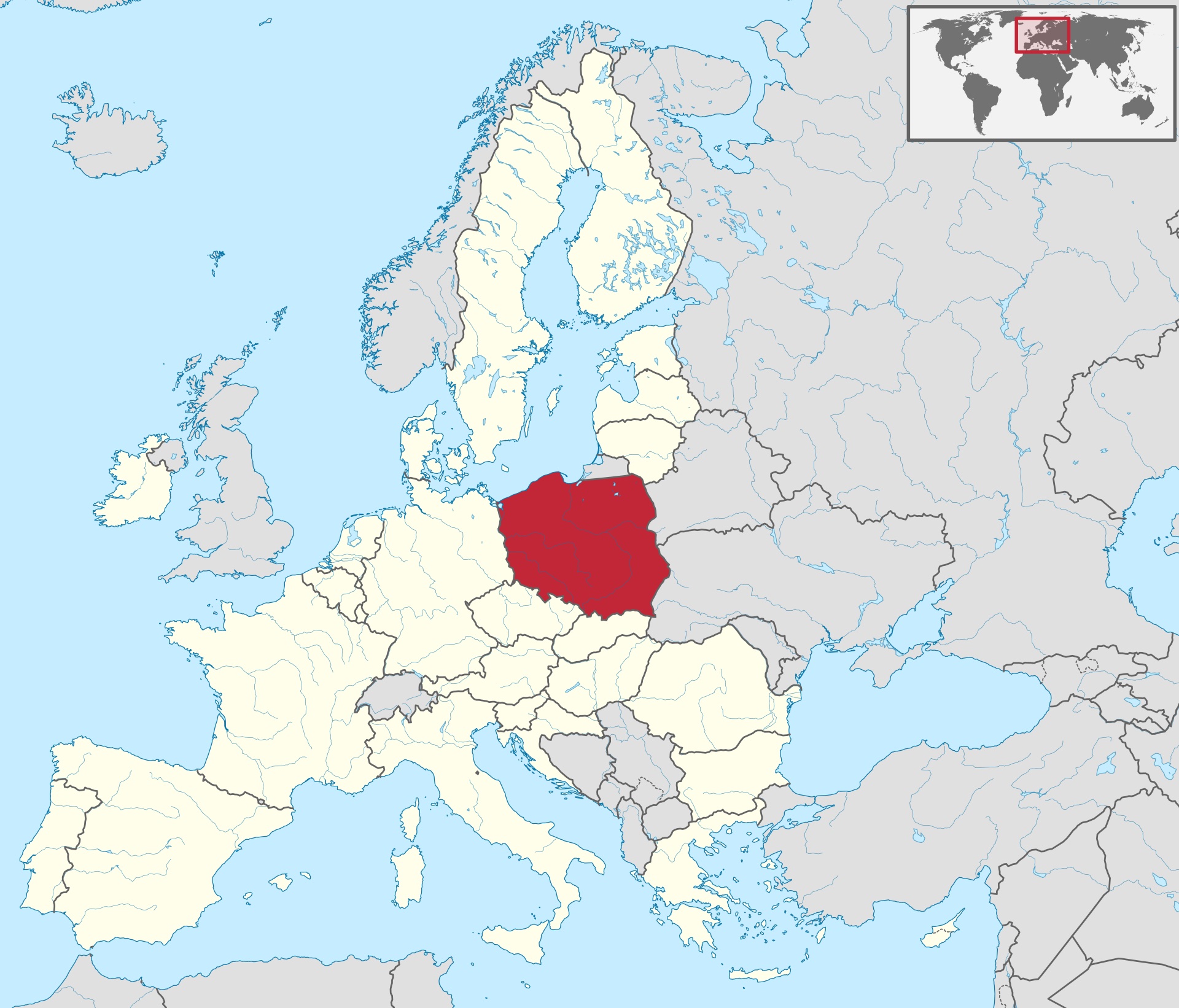
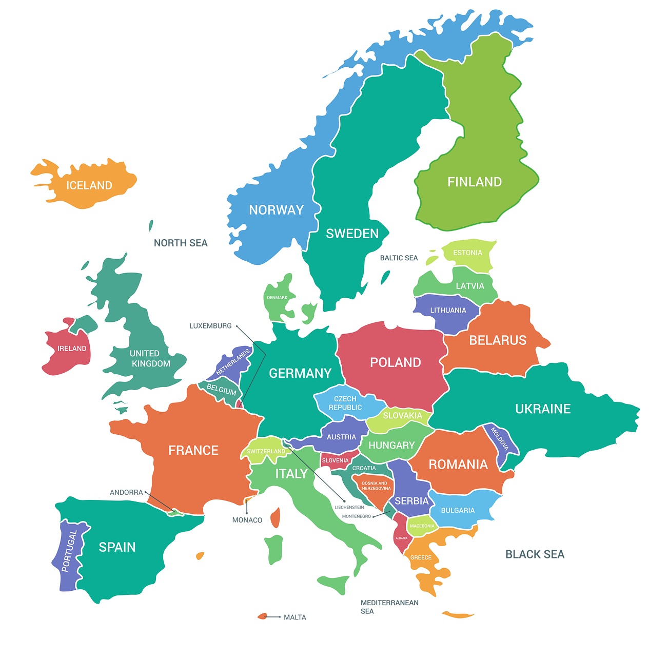
Poland is a large country which is located in Central Europe. We border 7 countries. From the north, Poland borders with Russia (with its Kaliningrad Oblast) and Lithuania, from the east with Belarus and Ukraine, from the south with Slovakia and the Czech Republic, and from the west with Germany. Most of Poland's northern border is marked by the coast of the Baltic Sea. The administrative area of Poland is 312,696 km², which gives it the 9th place in Europe. Poland is inhabited by over 37 million people, which gives it the 5th place in the European Union. Poland belongs, among others, to the European Union, the Schengen area, NATO, the UN, the OSCE and the Council of Europe.
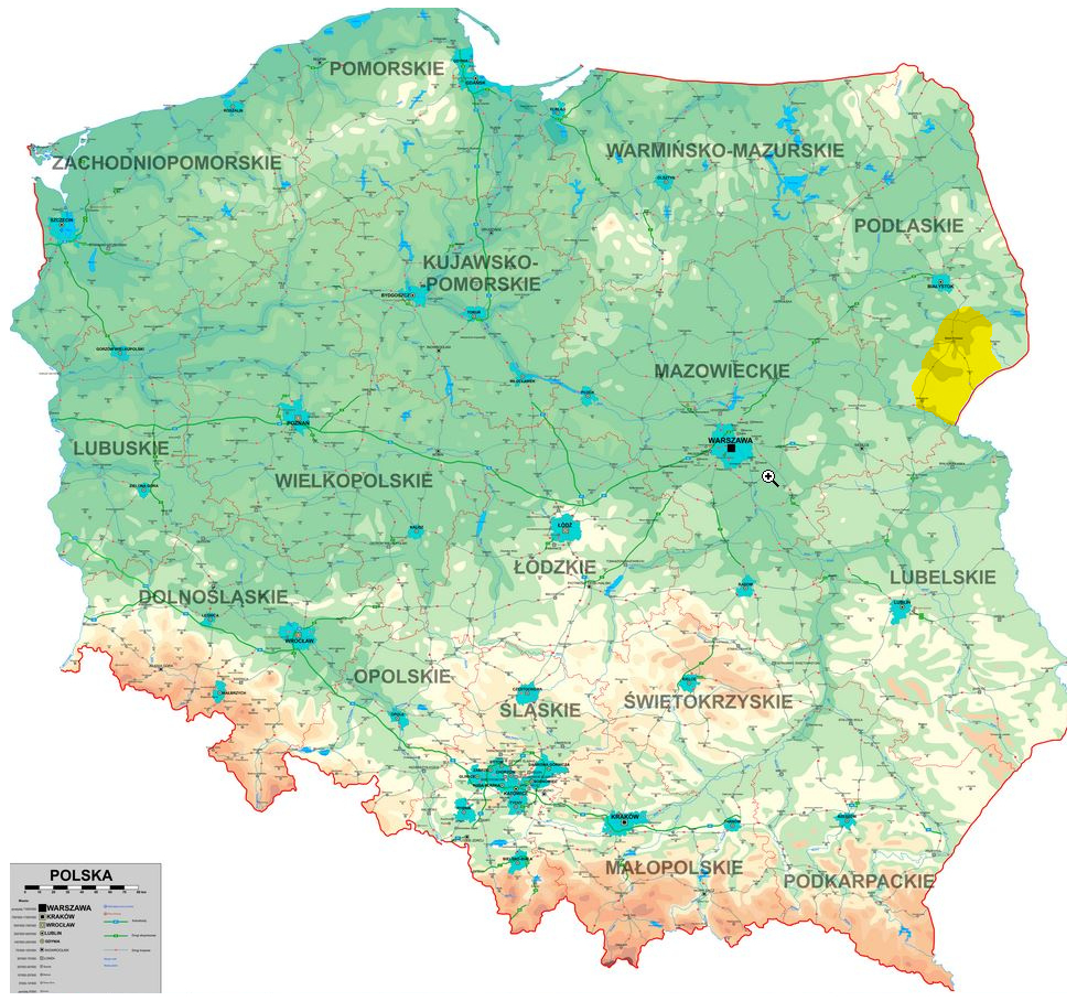
This map shows how our topography changes. From the Baltic Sea in the north and the lowlands, through the highlands to the mountains. The highest mountains in Poland are the Tatras. The highest peak is Rysy with a height of 2499 m above sea level. The largest city of Poland and at the same time the capital is Warsaw. Other metropolises are Kraków, Wrocław, Łódź, Poznań, Gdańsk and Szczecin.
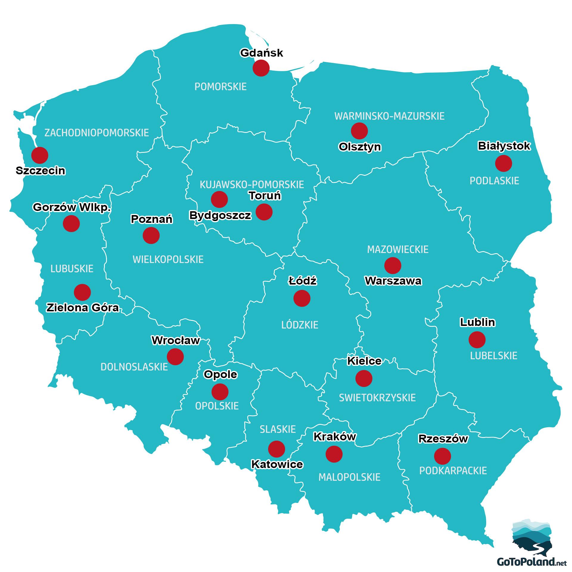
Here you can see Poland divided into voivodeships. We have 16 voivodeships. The red dots are capitals of particular voivodeships.
This map clearly shows that Poland is in Central Europe. We have 7 neighbors: Germany, the Czech Republic, Slovakia, Ukraine, Belarus, Lithuania and Russia. The longest border is with the Czech Republic - 796 km, the shortest with Lithuania - 104 km.
And a map with a wider world perspective.
